“First Landmark,” Lost Half Century, is Found in Virginia
District Boundary Stone at Jones' Point Is Under Seawall.
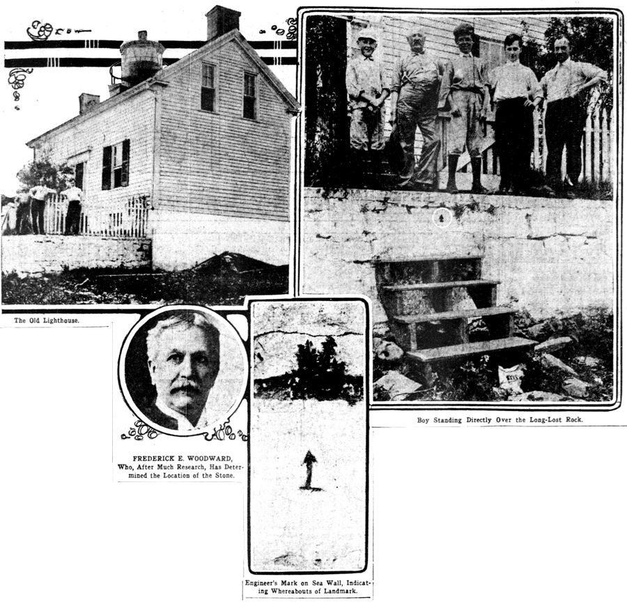
Following a careful study of old records, old newspapers, and old traditions. Fred E. Woodward, who has located other District boundary stones, has now found the lost corner stone, the “first landmark” on Jones' Point This is the stone at the southernmost corner of the District as ceded to the United Mates by the States of Maryland and Virginia, and is located on the Virginia aide of the river In the half of the District receded to the State in later time.
This stone, it has always been known, was located at Jones' Point, on the shore of Hunting Creek, below Alexandria. This location was known in a general way not only from President Washington's directions to the surveyors, but from old newspaper accounts, which Mr. Woodward has found including one in the “Massachusetts Spy,” written from Alexandria. Friday, June 15, 1791, the date upon which the stone was placed. The article describes the ceremonies incident to the setting of the stone.
Mr. Woodward's researches would have been unnecessary if in 1855 the Government had not built a lighthouse upon the point within fifteen feet of the stone and followed this up In 1861 with a seawall which extended over and up on the top of the stone, hiding it from view.
Hidden Many Years.
“There for more than fifty years,” says Mr. Woodward, “no one has seen this earliest landmark, an object worthy our highest esteem and admiration.
“This stone, still landing, though hidden from view, being under the gate way. In front of the south door of the lighthouse.”
Mr Woodward learned from the Engineer Corps of the War Department that “a report in that office made by Mr. Sinclair in 1884 on the triangulation of the District, mentions a mark made on the face of the wall when the stone was discovered. In 1861, undoubtedly for the express purpose or locating the stone, should this ever become necessary.”
This mark now has been found by Mr. Woodward, and there is no reasonable ground for doubting that the stone lies immediately beneath the mark.
From the data at hand, says Mr. Woodward, “It is almost certain that the stone can be located about two feet and six inches below the top of the sea wall and not more than seven to twelve inches back from the face of wall.”
Excavation Is Urged.
Mr. Woodward would like to see the Government authorize an excavation which shall exhibit to the sight this venerable and noteworthy relic of an earlier day.
It will take, he says, but a small amount of money, and not much more would be necessary to protect the stone. “Such protection,” he argues “might be secured by making a cement or masonry niche In the present wall, protecting it in front by iron bars or gratings, or the stone itself might be raised so as to bring it up to the level of the top of the wall.”
It is the discovery in Engineer Corps records by Mr. Woodward of the note made by Mr. Sinclair in 1884 that gives the real clue to the location of the stone.


